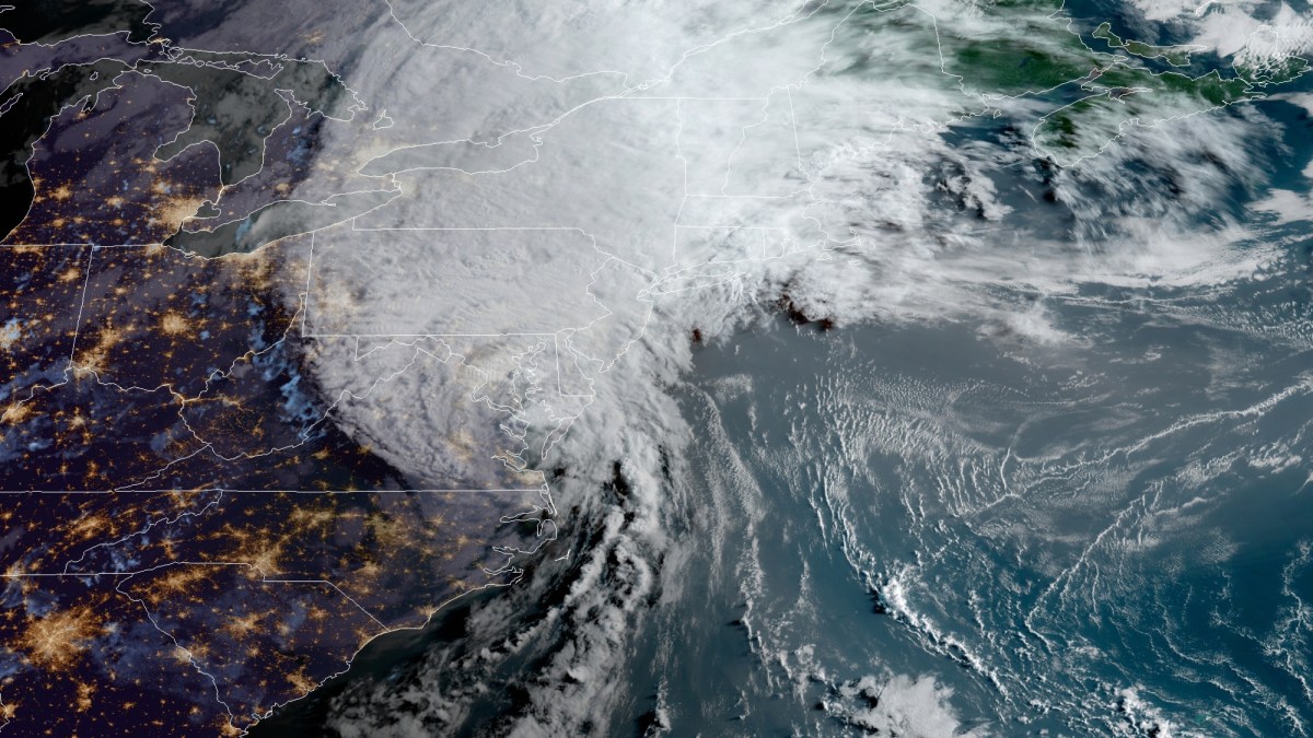
What to Know
- The entire Philadelphia area is under a First Alert Tuesday for drenching rain, flooding concerns and strong winds from Isaias.
- Coastal and inland counties in New Jersey, Delaware and Pennsylvania are under tropical storm warnings as Isaias makes its way northward.
- Tornado warnings and watches were issued Tuesday morning as the heart of the storm approached the region.
People in parts of Delaware and Bucks County are being told to seek shelter due to tornado warnings as Tropical Storm Isaias headed toward the region.
A tornado warning is in effect until 8:45 a.m. in northwestern Bucks County. This one covers the area around Bedminster.
Tornado warnings are in effect for central Kent County, including Dover, until 9 a.m. and in Sussex County in southern Delaware until 8:45 a.m.
Seek shelter and get away from windows if a tornado warning is issued in your area.
The tornado threats mean that there is rotation in a thunderstorm in the area. The warnings often pop up quickly and don't last long.
Tornado warnings in the western part of Philadelphia, southeastern Montgomery County, northeastern Chester County, northeastern Delaware County in Pennsylvania and parts of Sussex County, Delaware, have expired.
Tornado watches remain in effect for Philadelphia, the immediate suburbs, all of Delaware and South Jersey until 4 p.m.
Besides tornado threats, Isaias is expected to bringing flooding rains, strong winds and power outages to the region. Tropical storm warnings are in effect for much of the region.
Isaias was downgraded from hurricane strength after it made landfall Monday night in the Carolinas. The storm still packed 70 mph winds and heavy rain as it moved north near the Maryland-Virginia border around 8 a.m. Tuesday.
The outer bands of the storm began lashing the Philadelphia region overnight.
A FIRST ALERT is in effect for our area Tuesday due to the stormy impact of Isaias, which is expected to bring flash flooding, power outages and coastal flooding to our region. The First Alert kicked in at 7 p.m. Monday as drenching rain began.
The greatest impacts of Isaias are expected later on Tuesday morning into the afternoon. Flash flooding is a greater concern in Pennsylvania, while damaging winds gusts are more likely in Delaware and New Jersey.
Gov. Phil Murphy declared a State of Emergency for New Jersey Monday night ahead of Isaias.
Tropical storm warnings were already in effect Monday for area counties in Pennsylvania, New Jersey and Delaware, with the exception of Berks County and the Lehigh Valley. The risk of flash flooding, damaging wind and heavy downpours spreads to the entire region, including the northern and western suburbs.
"It is going to track right over our area," NBC10 First Alert Weather meteorologist Glenn "Hurricane" Schwartz said.
Rain could fall at 1 to 3 inches per hour during the heaviest rain bands expected late morning into the early afternoon. Widespread street, urban and stream flooding is expected from the heavy rain.
In addition, wind gusts up to 40 mph are possible in the Lehigh Valley, 60 mph in Philadelphia and 70 mph at the Shore. Widespread power outages are possible from these gusts.
Isaias is moving in from the south. The biggest impact will be flash flooding with 3 to 6-plus inches of rain likely across the area, with locally higher amounts in heavier rain bands. Some places could get 8 inches or more of drenching rain.
NBC10's Randy Gyllenhaal reports from Wilmington, Delaware, as rain ahead of Tropical Storm Isaias caused heavy downpours and road flooding Tuesday morning.
This will cause widespread flooding concerns Tuesday. The most vulnerable spots for flooding are in and around Philadelphia, the suburbs, Berks County and the Lehigh Valley. In these areas it takes much less rain to trigger flash flooding due to soil type and also recent heavy rainfall. Places like Reading, Pennsylvania, were already hit with inches of rain over the weekend.
Areas prone to flood, like the Brandywine Creek, face a big threat of flooding Tuesday.
Power outages are a concern form the heavy rain and wind. So, be sure to power up your devices.
In addition to heavy rain and strong wind, the coast will also experience dangerous rip currents and coastal flooding. The severity of the coastal flooding is still uncertain, but at least minor coastal flooding at high tide is possible Tuesday and Tuesday evening. Once the storm track is more certain, we will have a better idea if coastal flooding becomes a bigger concern. A dangerously high risk for rip currents is in effect Tuesday.
As of Monday night, Isaias made landfall in North Carolina with strong winds and heavy rainfall.
Isaias is expected to move quickly past our area as conditions could already start improving by late Tuesday afternoon. Sunshine and pleasant weather return Wednesday and Thursday with highs in the 80s, though there is a rain risk on Thursday.
Make sure you keep checking back with NBC10 News and download the NBC10 app for the latest on the storm.
"first" - Google News
August 04, 2020 at 07:24PM
https://ift.tt/3gsZC9m
FIRST ALERT: More Tornado Warnings as Isaias Roars Toward Philly Region - NBC 10 Philadelphia
"first" - Google News
https://ift.tt/2QqCv4E
https://ift.tt/3bWWEYd
Bagikan Berita Ini


0 Response to "FIRST ALERT: More Tornado Warnings as Isaias Roars Toward Philly Region - NBC 10 Philadelphia"
Post a Comment