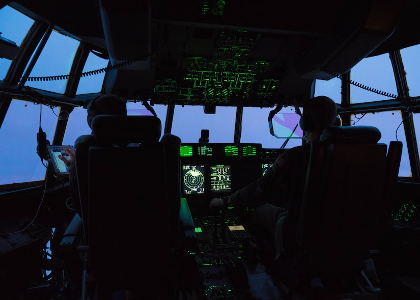
The Air Force Reserve Hurricane Hunter aircrews flew five weather reconnaissance missions into Hurricane Douglas, the season’s first hurricane in the Pacific Ocean, July 24-27, collecting data to assist Central Pacific Hurricane Center forecasters.
The 53rd Weather Reconnaissance Squadron, assigned to the 403rd Wing, Keesler Air Force Base, Mississippi, departed their home base, July 22, began flying missions into Hurricane Douglas from Kalaeloa Airport, July 24, and then moved operations to Kona International Airport, Hawaii, July 26, to get out of the path of the storm, and finished their last mission, July 27.
Douglas, which peaked as a Category 4 storm July 24 and began weakening throughout that day, is expected to continue to do so as it approaches the Hawaiian Islands and is projected to impact the islands until late Monday, according to the CPHC in Honolulu. When the Hurricane Hunters flew the storm July 26, it was Category 2.
The information the 53rd WRS collects assists forecasters, because while satellites do provide a lot of information, they don’t provide everything, said Maj. Grant Wagner, 53rd WRS mission commander for the weather deployment.
“The Pacific and Atlantic Oceans are data-sparse environments as they lack radar and weather balloons in the area,” Wagner said. “We are able to get into the storm, find the center, and get that ground-truth data that assists with movement and intensity forecasts. The data we collect can improve a forecast by anywhere from 15-25%.”
During a tropical storm or hurricane, a 53rd WRS aircrew, consisting of two pilots, an aerial reconnaissance weather officer, navigator and loadmaster, usually flies through the eye of a storm at about 10,000 feet four to six times, although on July 26, the crew flew through five times, said Maj. Tobi Baker, 53rd WRS ARWO, who directed the crew to the true center of the storm. During each pass through the eye, crews release a dropsonde, a meteorological instrument that collects temperature, wind speed, wind direction, humidity, and barometric pressure data as it descends to the ocean surface.
The aircraft also collects surface wind speed and flight-level data. This information is transmitted continuously throughout the flight to the NHC and CPHC to assist them with their forecasts and storm warnings.
“The data that’s provided by the Hurricane Hunters is very valuable,” said Eric Lau, Pacific Region National Weather Service meteorologist. “That ground-truth data really helps forecasters here; having the most up-to-date information on the storm helps us to provide the best forecast possible.”
In the initial stages of a storm, 53rd WRS crews will typically fly about every 12 hours, and as it approaches land, they will start to fly every six hours, Baker said.
Baker and his hurricane hunting counterparts are part of a unit that is the only Department of Defense organization still flying into tropical storms and hurricanes, a mission that began in 1944.
The squadron’s operations area ranges from the 55 longitude line in the Atlantic Ocean to the International Dateline in the Pacific Ocean. While other C-130 units receive taskings from the geographic combatant commander they support or the Air Force Reserve Command for training missions, the 53rd WRS receives their taskings from the National Hurricane Center, a Department of Commerce agency.
Through an interagency agreement, tropical weather reconnaissance is governed by the National Hurricane Operations Plan, which requires the squadron to support 24 hours-a-day continuous operations with the ability to fly up to three storms simultaneously and with a response time of 16 hours. To accomplish this, the squadron has 10 full time and 10 part-time Reserve aircrews available to fly 10 WC-130J Super Hercules to meet weather-reconnaissance taskings.
This was the case July 22-27, as it was a busy week for the Air Force Reserve squadron. In addition to deploying three aircraft and crews to fly Hurricane Douglas, the Hurricane Hunters also conducted recon operations into Hurricane Hanna, the first hurricane in the Atlantic Ocean, with three aircraft flying out of St. Croix, U.S. Virgin Islands, and flew Tropical Storm Gonzalo in the Gulf of Mexico, operating out of Keesler AFB. Hanna made landfall in south Texas as a Category 1 July 25 and Gonzalo dissipated July 26 over the southeastern Caribbean Sea, according to the National Hurricane Center in Miami.
Regardless of the challenges associated with the mission and its many moving parts, Baker said he enjoys the job because it helps people.
“These models and experience of the forecasters play into the creation of early watches and warnings of the people these storms effect,” he said. “Our small part plays a vital role in the emergency management system, which in turn affects everyone in the path of such storms.”
The risks they take though, do not go unnoticed.
“We really appreciate the risk that the Hurricane Hunters take to fly into these storms,” Lau said. “Their data provides the foundation to help us with our mission of protecting life and property.”
"first" - Google News
July 28, 2020 at 11:48PM
https://ift.tt/3f6Uoia
Hurricane Hunters fly first Pacific hurricane > US Air Force > Article Display - Air Force Link
"first" - Google News
https://ift.tt/2QqCv4E
https://ift.tt/3bWWEYd
Bagikan Berita Ini


0 Response to "Hurricane Hunters fly first Pacific hurricane > US Air Force > Article Display - Air Force Link"
Post a Comment